
LiDAR Scanning
WHY CHOOSE GNCB:
- Leader in 3D Laser Scanning
- Experienced Scan Technicians
- In-House Engineering and CAD/BIM Experts
- Fast Mobilization and Data Collection
- Survey-Grade Laser Scanners
- Optimized Workflow for Quick Turnaround
- Exceptional Service for Every Client
- Minimize Risk, Design Confidently, and Avoid Change Orders with LiDAR Scanning Services
GNCB OFFERS A SUITE OF INNOVATIVE 3D LASER SCANNING SERVICES, INCLUDING:
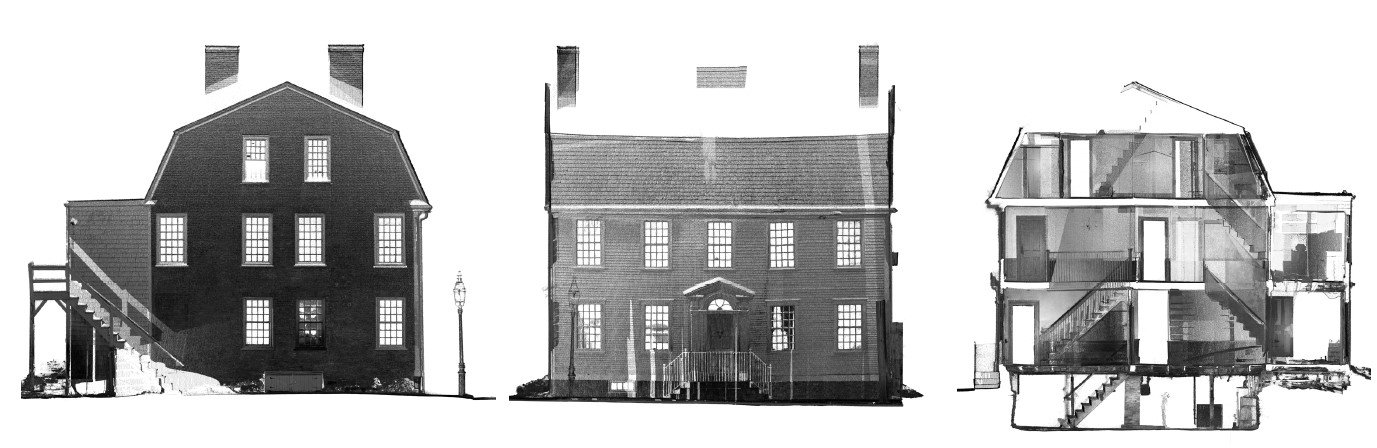
- 3D Terrestrial Laser Scanning (LiDAR) & Providing Registered Point Clouds and Regions
- Aerial & Ground based Drone Photogrammetry and Point Cloud Models
- 3D BIM / Revit Modeling
- 2D AutoCAD
- 360° Photographs (spherical)
- As-Built Surveys
- 2D paper drawing / PDF or CAD to 3D BIM Conversion
- Existing Conditions Building Survey
- Historical preservation & Architectural documentation
CAD MODELING SOFTWARE:
- Autodesk Recap Pro
- Autodesk AutoCAD
- Autodesk Recap Photo
- Autodesk Revit
- Leica Cyclone Register 360